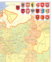
Localities in the 16th-century Polish Kingdom. The data is a result of a project dating back to the 1960s: "Historical Atlas of Poland. Detailed maps of the 16th century", The subject of the study (published in volumes from 1966 to 2021) are Polish lands in the second half of the 16th century. Each volume consists of two parts. The first includes a detailed main map (scale 1:250,000) showing settlement, relief, afforestation, parish network, state, and church administrative divisions, and roads, as well as overview maps (scale 1:500,000) dedicated to selected issues and plans of chosen cities (scale of 1:10,000). The second part is commentaries containing an overview of the source base, methods of elaboration, and lists of localities (including, name variations, and non-localized settlements) and physiographic names.
| Webpage | link |
Download options Complete metadata